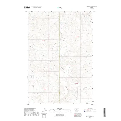
2020 Map of Griffin Coulee SW
USGS Topo · Published 2020About this map
Reservation Cr and its tributaries, including E Fork Reservation Cr, dominate this high plains landscape along the border of Treasure and Rosebud Counties. This modern survey illustrates a remote ranching and grazing region where drainage patterns dictate the placement of transportation routes. A network of unpaved local roads, such as Reservation Creek Rd and Cut Across Rd, follows the natural contours of the coulees and creek beds. Further south, the landscape is shaped by the headwaters of Beaver Cr and N Fork Trail Cr. The map provides a clear look at the Public Land Survey System divisions, including Township 4 North, Range 38 East and its neighbors, revealing how the land is partitioned across this section of southeastern Montana.
Find a feature on this map
23 named features on this map. Tap any name to fly to it.
Don’t see what you’re looking for? This feature index may not catch every label — zoom into the map to look around manually.
Map Details
Editions of this 2020 Griffin Coulee SW Map
This is the sole edition of this map. No revisions or reprints were ever made.
Other maps of this area

1954 · Hardin
USGS Topo · 1:250,000

1954 · Forsyth
USGS Topo · 1:250,000

1957 · Hardin
USGS Topo · 1:250,000

1957 · Forsyth
USGS Topo · 1:250,000

1958 · Forsyth
USGS Topo · 1:250,000

1958 · Hardin
USGS Topo · 1:250,000

1971 · Trail Creek School
USGS Topo · 1:24,000

1971 · Mc Clure Creek
USGS Topo · 1:24,000

1971 · Griffin Coulee SW
USGS Topo · 1:24,000

1971 · Griffin Coulee NE
USGS Topo · 1:24,000