
1965 Map of Griffin North
USGS Topo · Published 1967About this map
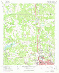
Industrial and agricultural development defines the northern landscape of Griffin during the mid-1960s. The map captures the specialized footprint of State Experimental Farms and the bustling district of Experiment, located just north of the city center. Along the Southern and Central of Georgia railroads, the textile heritage of the region is evident at Highland Mills. To the west, the recently established Heads Creek Reservoir stands as a significant hydrological feature, with its spillway clearly marked.
Find a feature on this map
78 named features on this map. Tap any name to fly to it.
Don’t see what you’re looking for? This feature index may not catch every label — zoom into the map to look around manually.
Map Details
Editions of this 1965 Griffin North Map
2 editions found
Other maps of this area

1951 · Barnesville
USGS Topo · 1:62,500

1953 · Atlanta
USGS Topo · 1:250,000

1957 · Atlanta
USGS Topo · 1:250,000

1958 · Atlanta
USGS Topo · 1:250,000

1964 · Luella
USGS Topo · 1:24,000
1964 · Mc Donough
USGS Topo · 1:24,000
1965 · Hampton
USGS Topo · 1:24,000

1965 · Fayetteville
USGS Topo · 1:24,000

1965 · Brooks
USGS Topo · 1:24,000

1971 · Hollonville
USGS Topo · 1:24,000