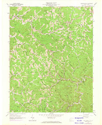
1962 Map of Griffithsville
USGS Topo · Published 1973About this map
Griffithsville and the surrounding hollows of Duval and Washington districts are shown here during a period of significant natural resource extraction. The landscape is densely populated with gas and oil wells, connected by a network of pipelines and primitive roads that snake through the ridges and valleys. Evidence of the region's mid-century rural life is visible in the numerous small educational and spiritual centers, such as Duval High Sch, Woodville Sch, and Sycamore Grove Ch.
Find a feature on this map
107 named features on this map. Tap any name to fly to it.
Don’t see what you’re looking for? This feature index may not catch every label — zoom into the map to look around manually.
Map Details
Editions of this 1962 Griffithsville Map
3 editions found
Other maps of this area

1892 · Huntington
USGS Topo · 1:125,000

1898 · Huntington
USGS Topo · 1:125,000

1899 · Charleston
USGS Topo · 1:125,000

1902 · Milton
USGS Topo · 1:62,500

1902 · Midkiff
USGS Topo · 1:62,500

1907 · Midkiff
USGS Topo · 1:62,500

1909 · Midkiff
USGS Topo · 1:62,500

1909 · Saint Albans
USGS Topo · 1:62,500

1911 · Madison
USGS Topo · 1:62,500

1929 · Madison
USGS Topo · 1:62,500