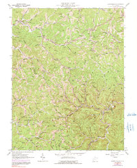
1962 Map of Griffithsville
USGS Topo · Published 1991About this map
Griffithsville anchors this mid-century look at the hills and hollows of the Lincoln and Boone county lines, where the landscape is defined by the dense distribution of the oil and gas industry. An intricate network of pipelines and service roads connects numerous gas and oil wells throughout the hills, including areas around Yawkey and Sumerco. This resource extraction economy sits alongside established rural communities, marked by small schools like Duval High Sch and Bulger Sch.
Find a feature on this map
101 named features on this map. Tap any name to fly to it.
Don’t see what you’re looking for? This feature index may not catch every label — zoom into the map to look around manually.
Map Details
Editions of this 1962 Griffithsville Map
3 editions found
Other maps of this area

1892 · Huntington
USGS Topo · 1:125,000

1898 · Huntington
USGS Topo · 1:125,000

1899 · Charleston
USGS Topo · 1:125,000

1902 · Milton
USGS Topo · 1:62,500

1902 · Midkiff
USGS Topo · 1:62,500

1907 · Midkiff
USGS Topo · 1:62,500

1909 · Midkiff
USGS Topo · 1:62,500

1909 · Saint Albans
USGS Topo · 1:62,500

1911 · Madison
USGS Topo · 1:62,500

1929 · Madison
USGS Topo · 1:62,500