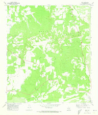
1970 Map of Grit
USGS Topo · Published 1973About this map
The Mason Mountains dominate the northern landscape of this Central Texas quadrangle, where the rugged topography transitions into ranching land carved by seasonal drainage. The small settlement of Grit sits at the junction of Highway 29 and Highway 377, serving as a focal point for the surrounding rural community. Evidence of local family history and early settlement is preserved in sites like the Grit Cem and Cavness Cem, while the hamlet of Streeter marks the western edge of the surveyed area. The map illustrates a landscape defined by water and terrain, from the prominent Double Knobs to the winding course of Honey Creek. Near the southern border, the community of Koockville and the nearby Koocks Branch reflect the enduring footprint of localized agricultural and residential centers during the early 1970s.
Find a feature on this map
24 named features on this map. Tap any name to fly to it.
Don’t see what you’re looking for? This feature index may not catch every label — zoom into the map to look around manually.
Map Details
Editions of this 1970 Grit Map
This is the sole edition of this map. No revisions or reprints were ever made.
Other maps of this area

1887 · Mason
USGS Topo · 1:125,000

1894 · Mason
USGS Topo · 1:125,000

1954 · Llano
USGS Topo · 1:250,000

1955 · Llano
USGS Topo · 1:250,000

1956 · Llano
USGS Topo · 1:250,000

1962 · Purdy Hill
USGS Topo · 1:24,000

1963 · Spy Rock
USGS Topo · 1:24,000
1967 · Mason
USGS Topo · 1:24,000
1968 · Turtle Creek
USGS Topo · 1:24,000

1968 · Sheep Run Creek
USGS Topo · 1:24,000