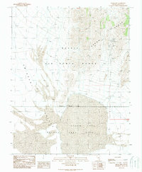
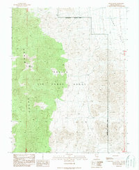
1989 Map of Groom Mine
USGS Topo · Published 1989About this map
Groom Range dominates the eastern landscape of this Nevada survey, a stark contrast to the flat expanse of Emigrant Valley and the dry bed of Groom Lake to the south. This 1989 edition, based on earlier 1968 aerial photography, provides a detailed record of the mining operations perched on the mountain slopes. The Groom Mine and Black Metal Mine are primary features, surrounded by scattered prospects and a Mine Shaft. The map highlights a significant intersection of military and industrial activity, with the Nevada Test Site and Nellis Air Force Range converging here. A marked Restricted Access Area underscores the highly secured nature of this desert terrain, where historical silver and lead mining interests met the requirements of the late-century national security infrastructure.
Find a feature on this map
12 named features on this map. Tap any name to fly to it.
Don’t see what you’re looking for? This feature index may not catch every label — zoom into the map to look around manually.
Map Details
Editions of this 1989 Groom Mine Map
This is the sole edition of this map. No revisions or reprints were ever made.
Other maps of this area

1942 · Emigrant Valley
USGS Topo · 1:125,000

1952 · Papoose Lake
USGS Topo · 1:62,500

1952 · Groom Mine
USGS Topo · 1:62,500

1954 · Caliente
USGS Topo · 1:250,000

1959 · Caliente
USGS Topo · 1:250,000
1961 · Jangle Ridge
USGS Topo · 1:24,000
1962 · Groom Mine SW
USGS Topo · 1:24,000

1985 · Pahranagat Range
USGS Topo · 1:100,000
1986 · Jangle Ridge
USGS Topo · 1:24,000
1989 · Groom Range
USGS Topo · 1:24,000