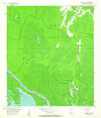
1953 Map of Grosse Tete SW
USGS Topo · Published 1962About this map
Bayou Grosse Tete and Bayou Maringouin snake through this low-lying Iberville Parish landscape, illustrating the complex water management systems of the mid-20th century. The area is dominated by the massive Upper Flat Floodway, a critical piece of spillway infrastructure protected by the East Protection Levee. The map reveals a transition between swampy wetlands and engineering projects, with Numerous Spoil Banks lining the Catfish Canal and other man-made cuts.
Find a feature on this map
16 named features on this map. Tap any name to fly to it.
Don’t see what you’re looking for? This feature index may not catch every label — zoom into the map to look around manually.
Map Details
Editions of this 1953 Grosse Tete SW Map
4 editions found

Other maps of this area

1935 · Osca Bayou
USGS Topo · 1:62,500

1935 · Chicot Lake
USGS Topo · 1:62,500

1940 · Grosse Tete
USGS Topo · 1:62,500

1941 · Loreauville
USGS Topo · 1:62,500

1953 · Crescent
USGS Topo · 1:24,000

1953 · Cow Bayou
USGS Topo · 1:24,000

1953 · Lobdell
USGS Topo · 1:24,000

1953 · Pigeon Bay
USGS Topo · 1:24,000

1953 · Maringouin
USGS Topo · 1:24,000

1953 · Addis
USGS Topo · 1:24,000