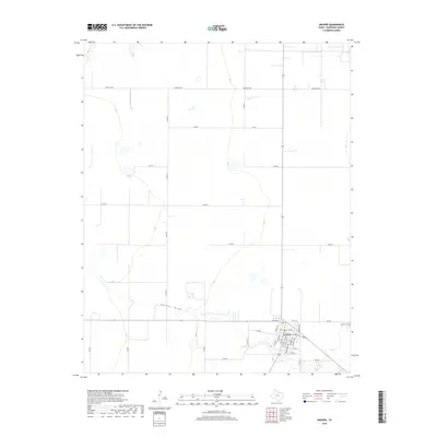
2019 Map of Gruver
USGS Topo · Published 2019About this map
Gruver serves as the central hub of this High Plains landscape in Hansford County, where the town’s grid is defined by streets like Richardson Ave and Womble Ave. The surrounding terrain is primarily characterized by a vast network of section roads and farm-to-market routes, including Farm Rd 2535 and Fm 278, which facilitate the region’s agricultural life. This 2019 survey shows the intersection of modern rural infrastructure with natural drainage features, most notably Farwell Draw, which meanders across the southern portion of the quadrangle. For those researching local heritage, the Gruver Cem is a prominent landmark situated just east of the main town site. The map captures the specialized land use of the Texas Panhandle, where the rigid geometry of county roads like Co Rd 10 and Co Rd N overlays the subtle topography of the plains.
Find a feature on this map
32 named features on this map. Tap any name to fly to it.
Don’t see what you’re looking for? This feature index may not catch every label — zoom into the map to look around manually.
Map Details
Editions of this 2019 Gruver Map
This is the sole edition of this map. No revisions or reprints were ever made.
Other maps of this area

1954 · Perryton
USGS Topo · 1:250,000

1958 · Perryton
USGS Topo · 1:250,000

1962 · Kimball
USGS Topo · 1:24,000

1962 · Hansford
USGS Topo · 1:24,000

1973 · Gruver
USGS Topo · 1:24,000

1974 · Hannas Draw East
USGS Topo · 1:24,000

1974 · Sunray 1 SE
USGS Topo · 1:24,000

1974 · Bernstein
USGS Topo · 1:24,000

1974 · Hannas Draw West
USGS Topo · 1:24,000

1974 · Sunray 1 NE
USGS Topo · 1:24,000