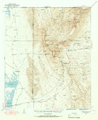
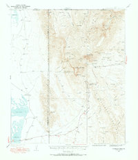
1933 Map of Guadalupe Peak
USGS Topo · Published 1967About this map
Guadalupe Peak Highest Point in Texas stands as the central landmark of this 1933 survey, marking the dramatic elevation change between the Salt Flats to the west and the Delaware Mountains to the east. The landscape is defined by its extreme verticality, where isolated structures like Pratt Lodge and Grisham Hunter Lodge are tucked into deep canyons such as North McKittrick Canyon. The mapping of numerous springs, including Juniper Spring and Choza Spring, highlights the critical role of water sources in this arid environment for early ranching operations like the Williams Ranch and Hegler Ranch.
Find a feature on this map
98 named features on this map. Tap any name to fly to it.
Don’t see what you’re looking for? This feature index may not catch every label — zoom into the map to look around manually.
Map Details
Editions of this 1933 Guadalupe Peak Map
6 editions found
Other maps of this area

1933 · Guadalupe Peak
USGS Topo · 1:48,000

1935 · El Paso Gap
USGS Topo · 1:62,500

1936 · El Paso Gap
USGS Topo · 1:48,000

1940 · El Paso Gap
USGS Topo · 1:62,500

1940 · Guadalupe Peak
USGS Topo · 1:62,500

1940 · Carlsbad Caverns West
USGS Topo · 1:62,500

1943 · Carlsbad Caverns West
USGS Topo · 1:62,500

1951 · Dell City
USGS Topo · 1:62,500

1954 · Carlsbad
USGS Topo · 1:250,000

1954 · Van Horn
USGS Topo · 1:250,000