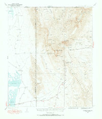
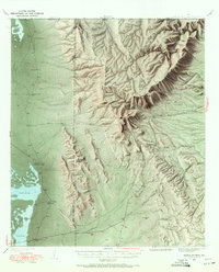
1933 Map of Guadalupe Peak
USGS Topo · Published 1972About this map
Guadalupe Peak towers over this 1933 survey, a landscape defined by the convergence of the Guadalupe Mountains and the Delaware Mountains. The map documents a sparse ranching economy where life centered on scattered water sources like Cherry Spring, Bone Spring, and the Indian Cave Tank. Remote outposts such as Old PX Ranch and Williams Ranch are connected by rugged trails and unimproved dirt roads that navigate around the vast Salt Lake Flats.
Find a feature on this map
83 named features on this map. Tap any name to fly to it.
Don’t see what you’re looking for? This feature index may not catch every label — zoom into the map to look around manually.
Map Details
Editions of this 1933 Guadalupe Peak Map
6 editions found
Other maps of this area

1933 · Guadalupe Peak
USGS Topo · 1:48,000

1935 · El Paso Gap
USGS Topo · 1:62,500

1936 · El Paso Gap
USGS Topo · 1:48,000

1940 · El Paso Gap
USGS Topo · 1:62,500

1940 · Guadalupe Peak
USGS Topo · 1:62,500

1940 · Carlsbad Caverns West
USGS Topo · 1:62,500

1943 · Carlsbad Caverns West
USGS Topo · 1:62,500

1951 · Dell City
USGS Topo · 1:62,500

1954 · Carlsbad
USGS Topo · 1:250,000

1954 · Van Horn
USGS Topo · 1:250,000