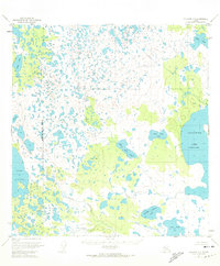
1951 Map of Gulkana B-5
USGS Topo · Published 1974About this map
Glacial topography and extensive wetlands define this 1951 survey of the Matanuska-Susitna Borough, where a complex network of thousands of small unnamed ponds surrounds larger bodies like Crosswind Lake (Charley Lake) and Lake Louise. The landscape is interrupted by subtle elevations such as First Hill and Second Hill, which rise above the muskeg.
Find a feature on this map
17 named features on this map. Tap any name to fly to it.
Don’t see what you’re looking for? This feature index may not catch every label — zoom into the map to look around manually.
Map Details
Editions of this 1951 Gulkana B-5 Map
2 editions found
Other maps of this area

1949 · Gulkana A-5
USGS Topo · 1:63,360

1949 · Gulkana A-6
USGS Topo · 1:63,360

1950 · Gulkana C-4
USGS Topo · 1:63,360

1950 · Gulkana B-6
USGS Topo · 1:63,360

1951 · Gulkana
USGS Topo · 1:250,000

1951 · Gulkana B-5
USGS Topo · 1:63,360

1951 · Gulkana A-4
USGS Topo · 1:63,360

1951 · Gulkana C-5
USGS Topo · 1:63,360

1951 · Gulkana B-4
USGS Topo · 1:63,360

1951 · Gulkana C-6
USGS Topo · 1:63,360