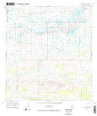
1951 Map of Gulkana D-5
USGS Topo · Published 1967About this map
The Maclaren River and the high-elevation basin of the Middle Fork Gulkana River dominate this interior landscape, captured during the mid-century mapping of the Alaska Range foothills. The hydrography here is remarkably complex, characterized by the chain of the Tangle Lakes in the northeast and the isolated Dickey Lake which feeds the Gulkana system. These water bodies are connected by a network of seasonal drainages and glacial remainders like Twin Lakes, illustrating the primitive drainage patterns of the Matanuska-Susitna region before modern infrastructure.
Find a feature on this map
10 named features on this map. Tap any name to fly to it.
Don’t see what you’re looking for? This feature index may not catch every label — zoom into the map to look around manually.
Map Details
Editions of this 1951 Gulkana D-5 Map
3 editions found
Other maps of this area

1949 · Mount Hayes A-4
USGS Topo · 1:63,360

1949 · Mount Hayes A-5
USGS Topo · 1:63,360

1950 · Mount Hayes
USGS Topo · 1:250,000

1950 · Gulkana D-4
USGS Topo · 1:63,360

1950 · Gulkana C-4
USGS Topo · 1:63,360

1950 · Mount Hayes A-6
USGS Topo · 1:63,360

1951 · Gulkana
USGS Topo · 1:250,000

1951 · Mount Hayes
USGS Topo · 1:250,000

1951 · Gulkana D-6
USGS Topo · 1:63,360

1951 · Gulkana D-5
USGS Topo · 1:63,360