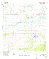
1951 Map of Gulkana D-6
USGS Topo · Published 1981About this map
The Maclaren River dominates this sub-arctic landscape, winding through a glacial valley where the South Boundary Fairbanks Meridian intersects the wilderness. This 1951 survey, with minor revisions noted through 1977, documents a territory defined by high-elevation survey markers and remote outpost structures. A solitary cabin sits on a northern bend of the river, providing a rare sign of human presence in a terrain otherwise characterized by its hydrologic and topographic features. To the south, Monsoon Lake and the headwaters of Moose Creek are flanked by prominent peaks like Vabm 4224 Horn and Vabm 5275 Laren. The western edge is defined by Clearwater Creek, which flows through an area of swamps and low relief, illustrating the drainage patterns of the Matanuska-Susitna region before modern development.
Find a feature on this map
12 named features on this map. Tap any name to fly to it.
Don’t see what you’re looking for? This feature index may not catch every label — zoom into the map to look around manually.
Map Details
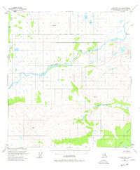
Editions of this 1951 Gulkana D-6 Map
3 editions found
Other maps of this area

1949 · Healy A-1
USGS Topo · 1:63,360

1949 · Mount Hayes A-5
USGS Topo · 1:63,360

1950 · Talkeetna Mountains
USGS Topo · 1:250,000

1950 · Mount Hayes
USGS Topo · 1:250,000

1950 · Mount Hayes A-6
USGS Topo · 1:63,360

1951 · Healy
USGS Topo · 1:250,000

1951 · Gulkana
USGS Topo · 1:250,000

1951 · Mount Hayes
USGS Topo · 1:250,000

1951 · Gulkana D-6
USGS Topo · 1:63,360

1951 · Gulkana D-5
USGS Topo · 1:63,360