
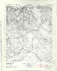
1943 Map of Gum Swamp
USGS Topo · Published 1943About this map
The Great Pee Dee River dictates the landscape of this wartime survey, carving a complex path through the South Carolina lowcountry. Large landforms like Byrds Island and Witherspoon Island sit within the river’s reach, highlighting a terrain defined by swamps and drainage canals. The human footprint is recorded through a high density of rural institutions, such as Hunts Bluff School and the Lower Marlboro High School, which served the scattered farming communities during the early 1940s.
Find a feature on this map
40 named features on this map. Tap any name to fly to it.
Don’t see what you’re looking for? This feature index may not catch every label — zoom into the map to look around manually.
Map Details
Editions of this 1943 Gum Swamp Map
2 editions found
Other maps of this area

1940 · Florence West
USGS Topo · 1:62,500

1940 · Florence East
USGS Topo · 1:62,500

1942 · Rockingham
USGS Topo · 1:125,000

1945 · Florence East
USGS Topo · 1:62,500

1945 · Florence West
USGS Topo · 1:62,500

1947 · Marion
USGS Topo · 1:24,000

1953 · Florence
USGS Topo · 1:250,000

1954 · Florence
USGS Topo · 1:250,000

1960 · Latta
USGS Topo · 1:24,000

1960 · Dillon West
USGS Topo · 1:24,000