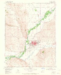
1954 Map of Gunnison
USGS Topo · Published 1965About this map
Gunnison sits at the confluence of the Gunnison River and Tomi Chi Creek, serving as a central hub for ranching and education in the mid-1950s. The town grid is clearly defined, anchored by Western State College on its eastern edge and the High Sch and Pine St Sch to the south. Transportation patterns reflect a transition from the rail era to the modern age, with the D & R G W RR still active alongside several stretches of Abandoned Railroad and an Old Railroad Grade branching toward the southwest. The surrounding landscape is defined by its water and high-altitude terrain, including the prominent Tenderfoot Mountain and various family-named agricultural sites like Thornton Ranch and McCabe Ranch. Notable local landmarks range from the Gunnison County Airport to the Lou Jay Resort, illustrating the area's development for both local industry and seasonal visitors.
Find a feature on this map
37 named features on this map. Tap any name to fly to it.
Don’t see what you’re looking for? This feature index may not catch every label — zoom into the map to look around manually.
Map Details
Editions of this 1954 Gunnison Map
5 editions found
Other maps of this area

1908 · Uncompahgre
USGS Topo · 1:125,000

1911 · Uncompahgre
USGS Topo · 1:125,000

1954 · Iris NW
USGS Topo · 1:24,000

1954 · Iola
USGS Topo · 1:24,000

1954 · Mc Intosh Mountain
USGS Topo · 1:24,000

1954 · Gunnison
USGS Topo · 1:24,000

1956 · Montrose
USGS Topo · 1:250,000

1959 · Montrose
USGS Topo · 1:250,000

1960 · Montrose
USGS Topo · 1:250,000

1962 · Iris
USGS Topo · 1:24,000