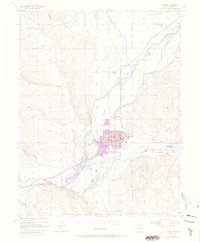
1954 Map of Gunnison
USGS Topo · Published 1973About this map
Gunnison serves as the focal point of this mid-century topographic study, showing a community defined by its proximity to the confluence of the Gunnison River and Tomichi Creek. The layout of the town reflects its institutional importance, anchored by the Western State College campus and the central Courthouse. Transportation patterns are in a state of transition during this era, with an Abandoned Railroad Grade and Abandoned RR corridors tracing the legacy of former narrow-gauge routes, while the Gunnison County Airport and the development of the Lou Jan Resort signal the area's growth as a hub for regional travel and recreation.
Find a feature on this map
37 named features on this map. Tap any name to fly to it.
Don’t see what you’re looking for? This feature index may not catch every label — zoom into the map to look around manually.
Map Details
Editions of this 1954 Gunnison Map
5 editions found
Other maps of this area

1908 · Uncompahgre
USGS Topo · 1:125,000

1911 · Uncompahgre
USGS Topo · 1:125,000

1954 · Iris NW
USGS Topo · 1:24,000

1954 · Iola
USGS Topo · 1:24,000

1954 · Mc Intosh Mountain
USGS Topo · 1:24,000

1954 · Gunnison
USGS Topo · 1:24,000

1956 · Montrose
USGS Topo · 1:250,000

1959 · Montrose
USGS Topo · 1:250,000

1960 · Montrose
USGS Topo · 1:250,000

1962 · Iris
USGS Topo · 1:24,000