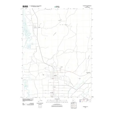
2011 Map of Gunnison
USGS Topo · Published 2011About this map
The San Pitch River flows through a valley anchored by the settlements of Gunnison and Centerfield, illustrating a classic central Utah agricultural and residential corridor. In this 2011 edition, the relationship between water and habitation is clear, with the South Extension Old Field Canal and the meandering Sevier River defining the western edge of the settled lands. Local history and genealogy points are well-represented by the Fayette Cemetery and Gunnison Cemetery, alongside the Gunnison Post Office and Centerfield Post Office.
Find a feature on this map
34 named features on this map. Tap any name to fly to it.
Don’t see what you’re looking for? This feature index may not catch every label — zoom into the map to look around manually.
Map Details
Editions of this 2011 Gunnison Map
This is the sole edition of this map. No revisions or reprints were ever made.
Other maps of this area

1885 · Manti
USGS Topo · 1:250,000

1895 · Manti
USGS Topo · 1:250,000

1956 · Price
USGS Topo · 1:250,000

1960 · Price
USGS Topo · 1:250,000

1962 · Price
USGS Topo · 1:250,000
1965 · Hells Kitchen Canyon SW
USGS Topo · 1:24,000

1965 · Hells Kitchen Canyon SE
USGS Topo · 1:24,000
1965 · Mayfield
USGS Topo · 1:24,000

1965 · Manti
USGS Topo · 1:24,000
1966 · Redmond Canyon
USGS Topo · 1:24,000