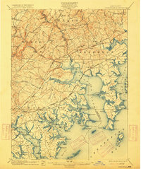
1901 Map of Gunpowder
USGS Topo · Published 1915About this map
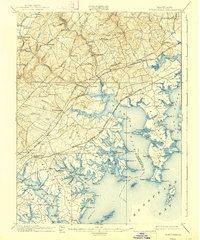
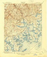
Gunpowder Falls and the Little Gunpowder Falls carve through the landscape of northeastern Maryland at the turn of the century, defining the boundaries of historic administrative districts like Bel Air District No. 3 and Abingdon District No. 1. The map reveals a transition from the agricultural uplands near Long Green and Jerusalem to the intricate, marshy shorelines of the Chesapeake Bay.
Find a feature on this map
145 named features on this map. Tap any name to fly to it.
Don’t see what you’re looking for? This feature index may not catch every label — zoom into the map to look around manually.
Map Details
Editions of this 1901 Gunpowder Map
7 editions found

Other maps of this area

1893 · North Point
USGS Topo · 1:62,500

1893 · Gunpowder
USGS Topo · 1:62,500

1894 · Baltimore
USGS Topo · 1:62,500

1894 · Relay
USGS Topo · 1:62,500

1898 · Tolchester
USGS Topo · 1:125,000

1899 · Baltimore
USGS Topo · 1:62,500

1900 · Havre De Grace
USGS Topo · 1:62,500

1900 · Betterton
USGS Topo · 1:62,500

1900 · Parkton
USGS Topo · 1:62,500

1901 · Belair
USGS Topo · 1:62,500