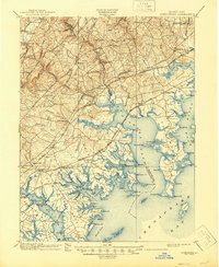
1901 Map of Gunpowder
USGS Topo · Published 1945About this map
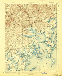
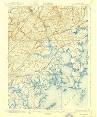
Battle Monument stands as a focal point near the northern shores of Back River and Middle River, anchoring a coastal landscape where the tide-water necks of Baltimore and Harford Counties meet the Chesapeake Bay. This turn-of-the-century environment is defined by its intricate shoreline, including Sue Pt. and Turkey Pt., which served as critical landmarks for local navigation and maritime industry. Inland, the map reveals a well-developed transportation network radiating from Baltimore, characterized by the Harford Turnpike and Bel Air Road. The presence of industrial and transit hubs like Harford Furnace and Joppa illustrates the area's transition from colonial origins to a thriving rail-and-road corridor. The Baltimore and Ohio RR and Philadelphia Wilmington and Baltimore RR cut through the terrain, connecting established settlements such as Abingdon and Kingsville to the growing regional markets.
Find a feature on this map
146 named features on this map. Tap any name to fly to it.
Don’t see what you’re looking for? This feature index may not catch every label — zoom into the map to look around manually.
Map Details
Editions of this 1901 Gunpowder Map
7 editions found

Other maps of this area

1893 · North Point
USGS Topo · 1:62,500

1893 · Gunpowder
USGS Topo · 1:62,500

1894 · Baltimore
USGS Topo · 1:62,500

1894 · Relay
USGS Topo · 1:62,500

1898 · Tolchester
USGS Topo · 1:125,000

1899 · Baltimore
USGS Topo · 1:62,500

1900 · Havre De Grace
USGS Topo · 1:62,500

1900 · Betterton
USGS Topo · 1:62,500

1900 · Parkton
USGS Topo · 1:62,500

1901 · Belair
USGS Topo · 1:62,500