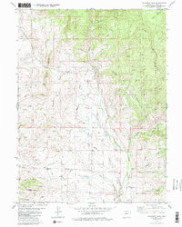
1980 Map of Gunsight Pass
USGS Topo · Published 1986About this map
Gunsight Pass and the surrounding high country of Grand County are defined here by a network of drainage basins and early resource extraction sites. The terrain is marked by numerous Prospect and Prospects locations, particularly concentrated around the slopes of Little Wolford Mountain and the western gulches, reflecting a landscape shaped by mineral exploration. Significant water management is evident through the presence of a Gaging Sta on Troublesome Creek and several Ditch segments diverted to manage flow across the high plateaus. The northeastern portion of the quadrangle includes a section of the Arapaho National Forest, where steep drainages like Buckhorn Creek and Siebert Creek descend from the ridges. This 1980s record captures the region's character as a place of remote ranching and mining potential, connected by a network of Trail and Jeep Trail routes that navigate the gaps between Antelope Pass and The Gunsight.
Find a feature on this map
31 named features on this map. Tap any name to fly to it.
Don’t see what you’re looking for? This feature index may not catch every label — zoom into the map to look around manually.
Map Details
Editions of this 1980 Gunsight Pass Map
3 editions found
Other maps of this area

1954 · Craig
USGS Topo · 1:250,000

1956 · Kremmling
USGS Topo · 1:62,500

1956 · Parkview Mountain
USGS Topo · 1:24,000

1956 · Whiteley Peak
USGS Topo · 1:24,000

1956 · Hyannis Peak
USGS Topo · 1:24,000

1956 · Hyannis Peak
USGS Topo · 1:62,500

1956 · Rand
USGS Topo · 1:62,500

1957 · Craig
USGS Topo · 1:250,000

1957 · Hot Sulphur Springs
USGS Topo · 1:62,500

1958 · Craig
USGS Topo · 1:250,000