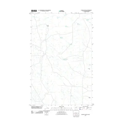
2011 Map of Gustin Coulee
USGS Topo · Published 2011About this map
Gustin Coulee defines the drainage pattern of this high plains landscape along the Montana-Saskatchewan border in Phillips County. The area is characterized by a sophisticated water management network designed to capture runoff in a semi-arid environment. Named catchments such as Titan Reservoir, Ada Reservoir, and the uniquely titled French Fry Number 2 Dam are scattered across the terrain, connected by intermittent stream beds and local access roads. This 2011 survey reveals how the local ranching and agricultural economy depends on these artificial water bodies, including Pea Lake and Split Rock Dam, which serve as critical infrastructure in a region otherwise sparse in permanent natural water sources.
Find a feature on this map
12 named features on this map. Tap any name to fly to it.
Don’t see what you’re looking for? This feature index may not catch every label — zoom into the map to look around manually.
Map Details
Editions of this 2011 Gustin Coulee Map
This is the sole edition of this map. No revisions or reprints were ever made.
Other maps of this area

1920 · Cowan
USGS Topo · 1:125,000

1954 · Glasgow
USGS Topo · 1:250,000

1957 · Glasgow
USGS Topo · 1:250,000

1958 · Glasgow
USGS Topo · 1:250,000

1984 · Pea Lake
USGS Topo · 1:24,000

1984 · Whitewater East
USGS Topo · 1:24,000

1984 · Whitewater West
USGS Topo · 1:24,000

1984 · Morgan
USGS Topo · 1:24,000
1984 · Gustin Coulee
USGS Topo · 1:24,000
1984 · Loring
USGS Topo · 1:24,000