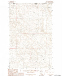
1984 Map of Gustin Coulee
USGS Topo · Published 1984About this map
Gustin Coulee dominates this northern Phillips County landscape, where the high plains of Montana meet the Saskatchewan border. This mid-1980s topographical study illustrates a region defined by critical water management in an arid environment, featuring a series of named catchments such as 3 Way No 2 Reservoir and Waterfowl Reservoir. These features, along with Walchuk Spring, suggest a reliance on these localized water sources for ranching or conservation during the late twentieth century. The boundary line between the United States and Canada is clearly delineated along the northern edge, marking the international extent of this prairie terrain. Small bodies of water like Pea Lake and Palea Reservoir are scattered throughout the quadrangle, highlighting the intricate drainage patterns that feed into the coulee system.
Find a feature on this map
14 named features on this map. Tap any name to fly to it.
Don’t see what you’re looking for? This feature index may not catch every label — zoom into the map to look around manually.
Map Details
Editions of this 1984 Gustin Coulee Map
This is the sole edition of this map. No revisions or reprints were ever made.
Other maps of this area

1920 · Cowan
USGS Topo · 1:125,000

1954 · Glasgow
USGS Topo · 1:250,000

1957 · Glasgow
USGS Topo · 1:250,000

1958 · Glasgow
USGS Topo · 1:250,000

1984 · Pea Lake
USGS Topo · 1:24,000

1984 · Whitewater East
USGS Topo · 1:24,000

1984 · Whitewater West
USGS Topo · 1:24,000

1984 · Morgan
USGS Topo · 1:24,000
1984 · Loring
USGS Topo · 1:24,000
2011 · Gustin Coulee
USGS Topo · 1:24,000