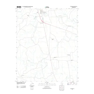
2012 Map of Guthrie
USGS Topo · Published 2012About this map
The small settlement of Guthrie serves as the focal point of this King County landscape, situated near the confluence of the S Wichita River and various local drainages. The area is defined by a distinct ranching and water-management infrastructure, evidenced by a high density of named windmills scattered across the terrain. These include the Old Wooden Town Windmill, Salt Knobs Windmill, and Ralive Pen Windmill, which speak to the historical and ongoing necessity of tapping groundwater for livestock in this semi-arid region. North of the town center, Guthrie Lake provides a notable water feature, while the southern portion of the quadrangle is etched by the winding course of N Croton Cr and Brushy Cr. Transportation routes such as 6666 RD Road 6666 and Co Rd 415 link the isolated ranch lands to the street grid of the town, which is organized by numbered streets like 5th St and 14th St.
Find a feature on this map
26 named features on this map. Tap any name to fly to it.
Don’t see what you’re looking for? This feature index may not catch every label — zoom into the map to look around manually.
Map Details
Editions of this 2012 Guthrie Map
This is the sole edition of this map. No revisions or reprints were ever made.
Other maps of this area

1954 · Lubbock
USGS Topo · 1:250,000

1958 · Southerland Canyon
USGS Topo · 1:24,000

1959 · Bob Creek
USGS Topo · 1:24,000

1966 · J Y Ranch
USGS Topo · 1:24,000

1967 · Guthrie NW
USGS Topo · 1:24,000

1967 · Dark Canyon
USGS Topo · 1:24,000

1967 · Fourmile Hill
USGS Topo · 1:24,000

1967 · Kiowa Peak NW
USGS Topo · 1:24,000

1968 · Guthrie
USGS Topo · 1:24,000

1968 · Pitchfork Flats
USGS Topo · 1:24,000