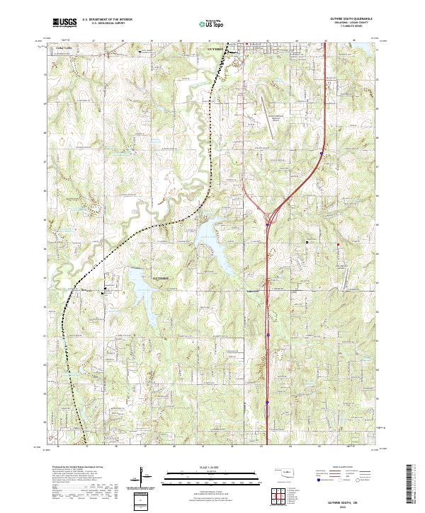
2022 Map of Guthrie South
USGS Topo · Published 2022About this map
Guthrie anchors this detailed survey of southern Logan County, showcasing a landscape transitioning from the city's historic core into a patchwork of water management and rural residential growth. The area is heavily defined by the Cottonwood Cr drainage system, which features a series of designated flood control and water storage sites including Cottonwood Cr Site 2 Reservoir and Cottonwood Cr Site 5 Reservoir. Near the center of the sheet, Guthrie Lake and Guthrie City Lake serve as significant local landmarks adjacent to the Guthrie/Edmond Regional Airport.
Find a feature on this map
92 named features on this map. Tap any name to fly to it.
Don’t see what you’re looking for? This feature index may not catch every label — zoom into the map to look around manually.
Map Details
Editions of this 2022 Guthrie South Map
This is the sole edition of this map. No revisions or reprints were ever made.
Other maps of this area

1892 · Guthrie
USGS Topo · 1:62,500

1892 · Edmond
USGS Topo · 1:62,500

1892 · Kingfisher
USGS Topo · 1:125,000

1895 · Kingfisher
USGS Topo · 1:125,000

1935 · Edmond
USGS Topo · 1:48,000

1940 · Edmond
USGS Topo · 1:62,500

1954 · Oklahoma City
USGS Topo · 1:250,000

1957 · Oklahoma City
USGS Topo · 1:250,000

1963 · Oklahoma City
USGS Topo · 1:250,000
1966 · Arcadia
USGS Topo · 1:24,000