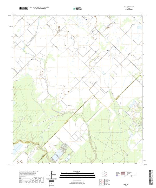
2022 Map of Guy
USGS Topo · Published 2022About this map
Guy sits at the center of this rural landscape, where the flat coastal plains of Texas are defined by the convergence of Fort Bend, Wharton, and Brazoria counties. The area is heavily intersected by seasonal drainages, most notably Mound Cr, Buffalo Creek, and Cedar Cr, which lead toward the San Bernard River in the southwest. A significant geological feature, Damon Mound, rises in the southeast, contrasting with the surrounding lowlands. The settlement patterns reflect a deep-rooted agricultural and local history, anchored by the New Prospect Baptist Church and its associated Church Cem, along with the Guy Cem to the north. The road network, including the namesake Cedar Creek Dr and various levee roads, suggests a landscape carefully managed for drainage and access to scattered homesteads and farming operations in this tri-county border region.
Find a feature on this map
69 named features on this map. Tap any name to fly to it.
Don’t see what you’re looking for? This feature index may not catch every label — zoom into the map to look around manually.
Map Details
Editions of this 2022 Guy Map
This is the sole edition of this map. No revisions or reprints were ever made.
Other maps of this area

1950 · Houston
USGS Topo · 1:250,000

1952 · West Columbia
USGS Topo · 1:24,000

1952 · Danciger
USGS Topo · 1:24,000

1952 · Pledger
USGS Topo · 1:24,000

1953 · Needville
USGS Topo · 1:24,000

1953 · Guy
USGS Topo · 1:24,000

1953 · Lake George
USGS Topo · 1:24,000

1953 · Kendleton
USGS Topo · 1:24,000

1953 · Damon
USGS Topo · 1:24,000

1953 · Boling
USGS Topo · 1:24,000