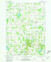
1968 Map of Hadley
USGS Topo · Published 1981About this map
Hadley sits at the heart of this landscape, where the agricultural plains of northern Michigan meet a dense cluster of glacial kettle lakes and wetlands. The map documents a significant transformation in progress, specifically the creation of Lake Lapeer, with blue hatching indicating areas destined to be submerged as the reservoir reached its normal pool elevation. This transition from natural stream drainage to man-made recreation is further emphasized by the sprawling boundaries of the Ortonville State Recreation Area to the south.
Find a feature on this map
78 named features on this map. Tap any name to fly to it.
Don’t see what you’re looking for? This feature index may not catch every label — zoom into the map to look around manually.
Map Details
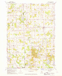
Editions of this 1968 Hadley Map
2 editions found
Other maps of this area

1920 · Flint
USGS Topo · 1:62,500

1920 · Holly
USGS Topo · 1:62,500

1922 · Holly
USGS Topo · 1:62,500

1922 · Flint
USGS Topo · 1:62,500

1943 · Holly
USGS Topo · 1:62,500

1943 · Flint
USGS Topo · 1:62,500

1943 · Ortonville
USGS Topo · 1:24,000

1943 · Oxford
USGS Topo · 1:24,000

1943 · Metamora
USGS Topo · 1:24,000

1945 · Oxford
USGS Topo · 1:24,000