
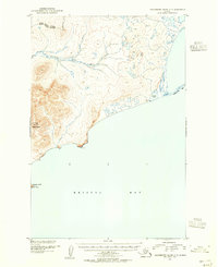
1954 Map of Hagemeister Island D-5
USGS Topo · Published 1968About this map
Susie Mountain and Kemuk Mountain anchor the western elevations of this coastal Alaskan landscape, which drains toward the southwest into Chagvan Bay. The interior is defined by a dense network of meandering waterways, most notably the Kinegnak River and Unaluk River, which weave through a complex system of ponds and wetlands. Along the coast, an extensive Tidal Flat area suggests the dynamic nature of the shoreline where the river systems meet the bay.
Find a feature on this map
12 named features on this map. Tap any name to fly to it.
Don’t see what you’re looking for? This feature index may not catch every label — zoom into the map to look around manually.
Map Details
Editions of this 1954 Hagemeister Island D-5 Map
This is the sole edition of this map. No revisions or reprints were ever made.
Other maps of this area

1948 · Hagemeister Island C-6
USGS Topo · 1:63,360

1948 · Hagemeister Island C-4
USGS Topo · 1:63,360

1948 · Hagemeister Island C-5
USGS Topo · 1:63,360

1950 · Hagemeister Island D-6
USGS Topo · 1:63,360

1950 · Hagemeister Island D-5
USGS Topo · 1:63,360

1951 · Goodnews
USGS Topo · 1:250,000

1951 · Hagemeister Island
USGS Topo · 1:250,000

1952 · Hagemeister Island C-6
USGS Topo · 1:63,360
1952 · Hagemeister Island C-5
USGS Topo · 1:63,360

1952 · Hagemeister Island C-4
USGS Topo · 1:63,360