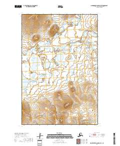
2018 Map of Hagemeister Island D-5 SW
USGS Topo · Published 2018About this map
Kinegnak sits at the northern edge of this coastal landscape, where the terrestrial drainage systems of southwestern Alaska meet the tides of Chagvan Bay. The map documents a complex hydraulic environment defined by the meandering courses of the Kinegnak River and the Unaluk River, which weave through low-lying terrain before reaching the Pacific Ocean. This area is characterized by an intricate network of wetlands and small water bodies, illustrating the fluid nature of the coastline in the Bethel Census Area.
Find a feature on this map
10 named features on this map. Tap any name to fly to it.
Don’t see what you’re looking for? This feature index may not catch every label — zoom into the map to look around manually.
Map Details
Editions of this 2018 Hagemeister Island D-5 SW Map
This is the sole edition of this map. No revisions or reprints were ever made.
Other maps of this area

1948 · Hagemeister Island C-6
USGS Topo · 1:63,360

1948 · Hagemeister Island C-5
USGS Topo · 1:63,360

1950 · Hagemeister Island D-6
USGS Topo · 1:63,360

1950 · Hagemeister Island D-5
USGS Topo · 1:63,360

1951 · Hagemeister Island
USGS Topo · 1:250,000

1952 · Hagemeister Island C-6
USGS Topo · 1:63,360
1952 · Hagemeister Island C-5
USGS Topo · 1:63,360

1954 · Hagemeister Island D-5
USGS Topo · 1:63,360

1957 · Hagemeister Island
USGS Topo · 1:250,000
2018 · Hagemeister Island C-6 NE
USGS Topo · 1:25,000