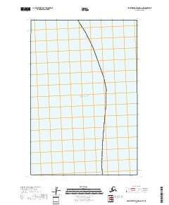
2018 Map of Hagemeister Island D-6 NW
USGS Topo · Published 2018About this map
Kuskokwim Bay and the vast expanse of the Pacific Ocean dominate this coastal survey in the Bethel Census Area. The map captures the meeting point of these significant water bodies along the Alaskan coastline, offering a clear record of the maritime boundary as it was documented in 2018. The terrestrial portion of the sheet is largely defined by the legal subdivisions of t14s r75w and t15s r75w, providing the essential framework for land management and public land survey system records in this remote maritime environment.
Find a feature on this map
13 named features on this map. Tap any name to fly to it.
Don’t see what you’re looking for? This feature index may not catch every label — zoom into the map to look around manually.
Map Details
Editions of this 2018 Hagemeister Island D-6 NW Map
This is the sole edition of this map. No revisions or reprints were ever made.
Other maps of this area

1950 · Hagemeister Island D-6
USGS Topo · 1:63,360

1951 · Kuskokwim Bay
USGS Topo · 1:250,000

1951 · Goodnews
USGS Topo · 1:250,000

1951 · Hagemeister Island
USGS Topo · 1:250,000

1954 · Goodnews A-8
USGS Topo · 1:63,360

1954 · Kuskokwim Bay
USGS Topo · 1:250,000

1957 · Hagemeister Island
USGS Topo · 1:250,000

1979 · Goodnews Bay
USGS Topo · 1:250,000
2017 · Goodnews Bay A-8 SW
USGS Topo · 1:25,000
2018 · Hagemeister Island D-6 SE
USGS Topo · 1:25,000