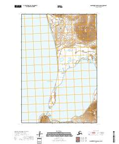
2018 Map of Hagemeister Island D-6 SE
USGS Topo · Published 2018About this map
Chagvan Bay dominates the coastal geography of this remote Alaskan coastline, where the waters of the Pacific Ocean meet a network of tidal flats and meandering watercourses. This landscape is defined by its transition from the upland drainage of the Salmon River and Happy Cr to the expansive maritime inlet. The map illustrates a coastline shaped by significant sediment transport, evident in the prominent spit that separates the sheltered bay from the open ocean.
Find a feature on this map
11 named features on this map. Tap any name to fly to it.
Don’t see what you’re looking for? This feature index may not catch every label — zoom into the map to look around manually.
Map Details
Editions of this 2018 Hagemeister Island D-6 SE Map
This is the sole edition of this map. No revisions or reprints were ever made.
Other maps of this area

1948 · Hagemeister Island C-6
USGS Topo · 1:63,360

1948 · Hagemeister Island C-5
USGS Topo · 1:63,360

1950 · Hagemeister Island D-6
USGS Topo · 1:63,360

1950 · Hagemeister Island D-5
USGS Topo · 1:63,360

1951 · Hagemeister Island
USGS Topo · 1:250,000

1952 · Hagemeister Island C-6
USGS Topo · 1:63,360
1952 · Hagemeister Island C-5
USGS Topo · 1:63,360

1954 · Hagemeister Island D-5
USGS Topo · 1:63,360

1957 · Hagemeister Island
USGS Topo · 1:250,000
2018 · Hagemeister Island C-6 NE
USGS Topo · 1:25,000