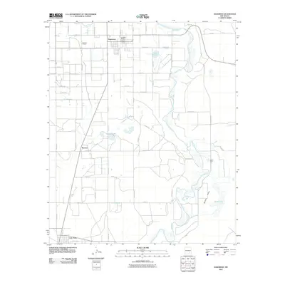
2010 Map of Hagerman
USGS Topo · Published 2010About this map
Hagerman and the surrounding Chaves County ranchlands are defined by the winding course of the Pecos River and its western tributary, the Rio Felix. This 2010 survey illustrates a landscape where water management and transportation are central to the local economy. The BNSF Railway corridor runs parallel to the main highway, connecting the town centers of Hagerman and Lake Arthur to regional markets. Local infrastructure, such as the Rio Feliz Bridge and Hagerman Post Office, provides a sense of community center, while the outskirts are marked by agricultural operations like Buffalo Valley Farm. The hydrology of the area is particularly detailed, showing numerous catchment areas including Lake Tolliver, Prichard Lakes, and the marshy expanses of Buffalo Lake. Genealogists will find the Hagerman Cemetery and early settlements like Mossman helpful for anchoring family locations within the Pecos Valley grid.
Find a feature on this map
59 named features on this map. Tap any name to fly to it.
Don’t see what you’re looking for? This feature index may not catch every label — zoom into the map to look around manually.
Map Details
Editions of this 2010 Hagerman Map
This is the sole edition of this map. No revisions or reprints were ever made.
Other maps of this area

1950 · Dexter West
USGS Topo · 1:24,000

1950 · Dexter East
USGS Topo · 1:24,000

1951 · Ninemile Well
USGS Topo · 1:24,000

1951 · Diamond Mound
USGS Topo · 1:24,000

1951 · Hagerman
USGS Topo · 1:24,000

1952 · Bar C Bar Ranch
USGS Topo · 1:24,000

1952 · Hagerman SW
USGS Topo · 1:24,000

1953 · Espuela
USGS Topo · 1:24,000

1954 · Carlsbad
USGS Topo · 1:250,000

1955 · Artesia NE
USGS Topo · 1:24,000