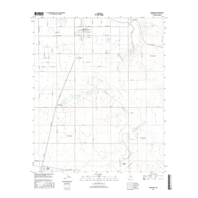
2017 Map of Hagerman
USGS Topo · Published 2017About this map
Hagerman and Lake Arthur anchor this agricultural and riverine landscape in the Pecos River Valley. The area is defined by a complex network of water management and natural drainage, where the Rio Felix flows toward the Pecos River near the northern boundary. The flat valley floor is dotted with numerous small water bodies, including Lake Tolliver, Prichard Lakes, and Buffalo Lake, illustrating the hydrological character of this portion of Chaves County.
Find a feature on this map
77 named features on this map. Tap any name to fly to it.
Don’t see what you’re looking for? This feature index may not catch every label — zoom into the map to look around manually.
Map Details
Editions of this 2017 Hagerman Map
This is the sole edition of this map. No revisions or reprints were ever made.
Other maps of this area

1950 · Dexter West
USGS Topo · 1:24,000

1950 · Dexter East
USGS Topo · 1:24,000

1951 · Ninemile Well
USGS Topo · 1:24,000

1951 · Diamond Mound
USGS Topo · 1:24,000

1951 · Hagerman
USGS Topo · 1:24,000

1952 · Bar C Bar Ranch
USGS Topo · 1:24,000

1952 · Hagerman SW
USGS Topo · 1:24,000

1953 · Espuela
USGS Topo · 1:24,000

1954 · Carlsbad
USGS Topo · 1:250,000

1955 · Artesia NE
USGS Topo · 1:24,000