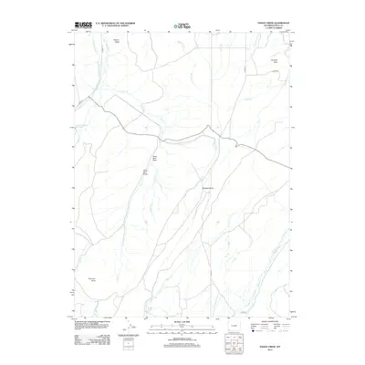
2012 Map of Hague Creek
USGS Topo · Published 2012About this map
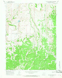
Bigelow Bench and Meyers Ridge define the high ground of this Uinta County landscape, where water management is central to the land's utility. Early 21st-century irrigation infrastructure is prominently marked by the Byrne Ditch Number 2 and the Pine Grove Canal, reflecting the ongoing effort to direct flow from Muddy Cr and Little Cr across this arid terrain. The Little Piedmont Reservoir serves as a key collection point in the northwest, while the southern reaches are drained by the intricate meanders of Blacks Fork and Horse Cr.
Find a feature on this map
30 named features on this map. Tap any name to fly to it.
Don’t see what you’re looking for? This feature index may not catch every label — zoom into the map to look around manually.
Map Details
Editions of this 2012 Hague Creek Map
This is the sole edition of this map. No revisions or reprints were ever made.
Other maps of this area

1954 · Ogden
USGS Topo · 1:250,000

1958 · Ogden
USGS Topo · 1:250,000

1960 · Ogden
USGS Topo · 1:250,000

1964 · Fort Bridger
USGS Topo · 1:24,000
1964 · Buck Fever Ridge
USGS Topo · 1:24,000
1964 · Robertson
USGS Topo · 1:24,000

1965 · Ragan
USGS Topo · 1:24,000

1965 · Leroy
USGS Topo · 1:24,000
1965 · Hague Creek
USGS Topo · 1:24,000
1965 · Moslander Reservoir
USGS Topo · 1:24,000