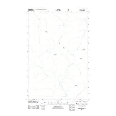
2011 Map of Hahn Creek Pass
USGS Topo · Published 2011About this map
Hahn Creek Pass serves as a central geographical landmark in this high-altitude region of Powell County, Montana. The landscape is defined by a complex drainage system where the headwaters of Hahn Creek and Otter Creek flow northward, while Monture Creek and its various branches, including the Middle Fork Monture Creek and East Fork Monture Creek, dominate the southern half of the quadrangle. The intersection of these water systems near Monture Falls illustrates the intricate hydrology of the area, providing a detailed look at the natural pathways through the mountains.
Find a feature on this map
15 named features on this map. Tap any name to fly to it.
Don’t see what you’re looking for? This feature index may not catch every label — zoom into the map to look around manually.
Map Details
Editions of this 2011 Hahn Creek Pass Map
This is the sole edition of this map. No revisions or reprints were ever made.
Other maps of this area

1902 · Ovando
USGS Topo · 1:125,000

1905 · Ovando
USGS Topo · 1:125,000

1955 · Choteau
USGS Topo · 1:250,000

1957 · Choteau
USGS Topo · 1:250,000

1958 · Choteau
USGS Topo · 1:250,000

1962 · Choteau
USGS Topo · 1:250,000

1965 · Morrell Mountain
USGS Topo · 1:24,000

1968 · Spread Mountain
USGS Topo · 1:24,000

1968 · Dunham Point
USGS Topo · 1:24,000
1970 · Crimson Peak
USGS Topo · 1:24,000