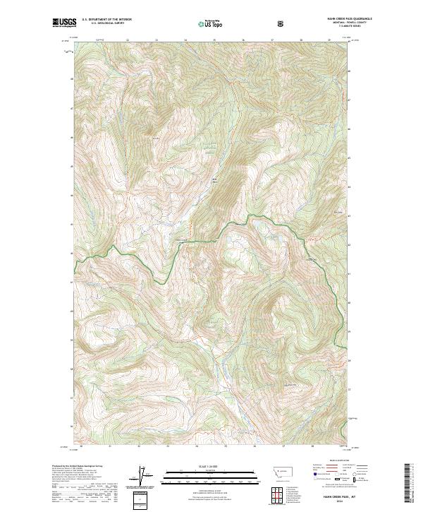
2024 Map of Hahn Creek Pass
USGS Topo · Published 2024About this map
Hahn Creek Pass marks a significant crossing point in the high country of Powell County, where the borders of the Bob Marshall Wilderness, Flathead National Forest, and Lolo National Forest converge. This 2024 landscape is defined by its complex drainage network, where waters flow from the slopes of Moser Mtn and Foolhen Mtn into Hahn Creek and the southern-reaching Monture Creek. The absence of roads emphasizes the backcountry nature of this terrain, which is instead navigated by a network of established paths such as the Hahn Creek Trl and Blackfoot Divide Trl. Local landmarks like Bear Park and the spectacular Monture Falls provide critical orientation points for those traversing the high ridges between Gust Mtn and Monahan Mtn. The map preserves the exact alignment of these historical trails as they follow natural contours through this protected wilderness.
Find a feature on this map
36 named features on this map. Tap any name to fly to it.
Don’t see what you’re looking for? This feature index may not catch every label — zoom into the map to look around manually.
Map Details
Editions of this 2024 Hahn Creek Pass Map
This is the sole edition of this map. No revisions or reprints were ever made.
Other maps of this area

1902 · Ovando
USGS Topo · 1:125,000

1905 · Ovando
USGS Topo · 1:125,000

1955 · Choteau
USGS Topo · 1:250,000

1957 · Choteau
USGS Topo · 1:250,000

1958 · Choteau
USGS Topo · 1:250,000

1962 · Choteau
USGS Topo · 1:250,000

1965 · Morrell Mountain
USGS Topo · 1:24,000

1968 · Spread Mountain
USGS Topo · 1:24,000

1968 · Dunham Point
USGS Topo · 1:24,000
1970 · Crimson Peak
USGS Topo · 1:24,000