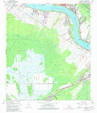
1967 Map of Hahnville
USGS Topo · Published 1977About this map
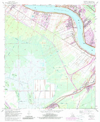
The Mississippi River creates a massive northern arc across this Louisiana landscape, defining the industrial and agricultural patterns of St. Charles Parish. Heavy industry is concentrated along the riverbanks, including a refinery and waterworks near Good Hope and New Sarpy, while the Bonnet Carre Floodway stands ready to manage the river's power. South of the riverside settlements like Hahnville and Destrehan, the terrain transitions into a complex network of canals and marshland, featuring Cypress Island and Bird Island.
Find a feature on this map
55 named features on this map. Tap any name to fly to it.
Don’t see what you’re looking for? This feature index may not catch every label — zoom into the map to look around manually.
Map Details
Editions of this 1967 Hahnville Map
5 editions found
Other maps of this area

1891 · Hahnville
USGS Topo · 1:62,500

1892 · Lac Des Allemands
USGS Topo · 1:62,500

1892 · Mount Airy
USGS Topo · 1:62,500

1892 · Bonnet Carre
USGS Topo · 1:62,500

1932 · Lac Des Allemands SE
USGS Topo · 1:31,680

1932 · Hahnville NW
USGS Topo · 1:31,680

1932 · Lac Des Allemands NE
USGS Topo · 1:31,680

1932 · Hahnville SW
USGS Topo · 1:31,680

1932 · Hahnville NE
USGS Topo · 1:31,680

1935 · Laplace
USGS Topo · 1:31,680