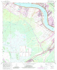
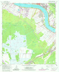
1967 Map of Hahnville
USGS Topo · Published 1989About this map
Hahnville and the surrounding riverfront settlements of St. Charles Parish define this landscape along the sweeping bends of the Mississippi River. The transition from the industrial corridor near Norco and Good Hope to the deep wetlands of the south is marked by an extensive network of drainage channels, including the Eighty Arpent Canal and Vial Canal. This intricate system reflects the constant effort to manage the water levels between the high Levee and the backswamps where Cypress Island and Bird Island rise from the marshy terrain.
Find a feature on this map
45 named features on this map. Tap any name to fly to it.
Don’t see what you’re looking for? This feature index may not catch every label — zoom into the map to look around manually.
Map Details
Editions of this 1967 Hahnville Map
5 editions found
Other maps of this area

1891 · Hahnville
USGS Topo · 1:62,500

1892 · Lac Des Allemands
USGS Topo · 1:62,500

1892 · Mount Airy
USGS Topo · 1:62,500

1892 · Bonnet Carre
USGS Topo · 1:62,500

1932 · Lac Des Allemands SE
USGS Topo · 1:31,680

1932 · Hahnville NW
USGS Topo · 1:31,680

1932 · Lac Des Allemands NE
USGS Topo · 1:31,680

1932 · Hahnville SW
USGS Topo · 1:31,680

1932 · Hahnville NE
USGS Topo · 1:31,680

1935 · Laplace
USGS Topo · 1:31,680