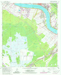
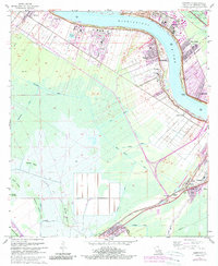
1967 Map of Hahnville
USGS Topo · Published 1980About this map
Hahnville and its surrounding parish seat operations serve as the central hub of this survey, where the Mississippi River makes a dramatic turn past the courthouse and Holy Rosary Ch. The landscape reveals a complex transition from the riverfront industry and levee-bound settlements like Norco and Good Hope to the deep wetlands of the south. This era shows significant industrial development, with a Refinery and large areas dedicated to Sewage Disposal and Industrial Waste near Taft. Farther inland, the map captures the structured drainage systems essential to this environment, including the Eighty Arpent Canal and Hymel Canal. These waterways navigate between islands of firmer ground such as Cypress Island and Bird Island, while the Texas and Pacific and Southern Pacific railroads anchor the inland communities of Paradis and Boutte.
Find a feature on this map
62 named features on this map. Tap any name to fly to it.
Don’t see what you’re looking for? This feature index may not catch every label — zoom into the map to look around manually.
Map Details
Editions of this 1967 Hahnville Map
5 editions found
Other maps of this area

1891 · Hahnville
USGS Topo · 1:62,500

1892 · Lac Des Allemands
USGS Topo · 1:62,500

1892 · Mount Airy
USGS Topo · 1:62,500

1892 · Bonnet Carre
USGS Topo · 1:62,500

1932 · Lac Des Allemands SE
USGS Topo · 1:31,680

1932 · Hahnville NW
USGS Topo · 1:31,680

1932 · Lac Des Allemands NE
USGS Topo · 1:31,680

1932 · Hahnville SW
USGS Topo · 1:31,680

1932 · Hahnville NE
USGS Topo · 1:31,680

1935 · Laplace
USGS Topo · 1:31,680