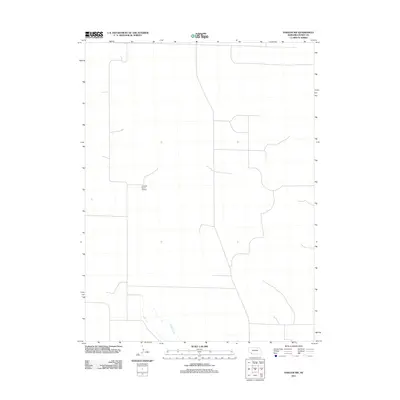
2011 Map of Haigler NW
USGS Topo · Published 2011About this map
The high plains of Dundy County are defined here by a sparse grid of section lines and the natural meandering path of Buffalo Creek. This area of southwestern Nebraska maintains a low-density rural character, where the landscape is organized primarily for agricultural and aviation utility. Central to this quadrangle is the Harford Ranch Airport, a private landing strip that underscores the reliance on small-scale aviation for navigating and managing the vast ranching properties of the region. The limited infrastructure shown reflects a late twentieth-century pattern of land use where isolated homesteads and ranching operations are connected by a network of local roads that follow the strict geometry of the Public Land Survey System, occasionally broken only by the drainage patterns of local waterways.
Find a feature on this map
2 named features on this map. Tap any name to fly to it.
Don’t see what you’re looking for? This feature index may not catch every label — zoom into the map to look around manually.
Map Details
Editions of this 2011 Haigler NW Map
This is the sole edition of this map. No revisions or reprints were ever made.
Other maps of this area

1954 · Sterling
USGS Topo · 1:250,000

1954 · McCook
USGS Topo · 1:250,000

1957 · McCook
USGS Topo · 1:250,000

1958 · McCook
USGS Topo · 1:250,000

1958 · Sterling
USGS Topo · 1:250,000
1961 · Rock Creek Lake
USGS Topo · 1:24,000
1961 · Haigler
USGS Topo · 1:24,000

1961 · Laird
USGS Topo · 1:24,000

1971 · Alvin
USGS Topo · 1:24,000

1971 · Wray NE
USGS Topo · 1:24,000