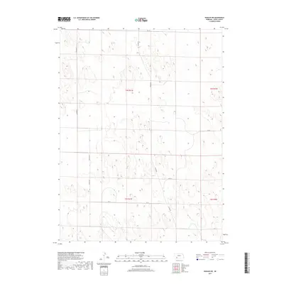
2017 Map of Haigler NW
USGS Topo · Published 2017About this map
Buffalo Cr cuts through the southwest corner of this high plains landscape in Dundy County, serving as the primary drainage for an otherwise arid expanse of rangeland. The map detail reflects the organized Public Land Survey System (PLSS) grid, with township boundaries like t3n r41w and t2n r41w defining the administrative layout of the territory. A sparse network of gravel and dirt routes, including Haigler Rd and Hartford Rd, provides the only infrastructure across these sections, following the section lines to connect isolated ranching operations. The terrain is characterized by subtle depressions and small, unnamed seasonal basins typical of the western Nebraska loess hills, where water management and land division are central to the local geography.
Find a feature on this map
12 named features on this map. Tap any name to fly to it.
Don’t see what you’re looking for? This feature index may not catch every label — zoom into the map to look around manually.
Map Details
Editions of this 2017 Haigler NW Map
This is the sole edition of this map. No revisions or reprints were ever made.
Other maps of this area

1954 · Sterling
USGS Topo · 1:250,000

1954 · McCook
USGS Topo · 1:250,000

1957 · McCook
USGS Topo · 1:250,000

1958 · McCook
USGS Topo · 1:250,000

1958 · Sterling
USGS Topo · 1:250,000
1961 · Rock Creek Lake
USGS Topo · 1:24,000
1961 · Haigler
USGS Topo · 1:24,000

1961 · Laird
USGS Topo · 1:24,000

1971 · Alvin
USGS Topo · 1:24,000

1971 · Wray NE
USGS Topo · 1:24,000