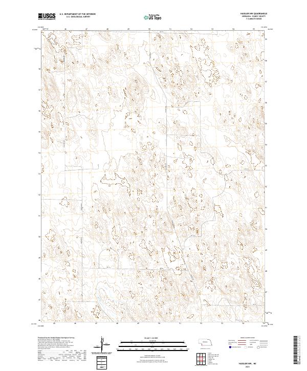
2021 Map of Haigler NW
USGS Topo · Published 2021About this map
Hartford Rd and Haigler Rd anchor the grid of this rural landscape in the northwest corner of Dundy County, Nebraska. This high-plains region is defined by a sparse but organized network of section roads, including Rd 719 along the northern border and Rd 711 in the southeast. The survey area covers portions of townships t3n r41w, t3n r40w, t2n r41w, and t2n r40w.
Find a feature on this map
11 named features on this map. Tap any name to fly to it.
Don’t see what you’re looking for? This feature index may not catch every label — zoom into the map to look around manually.
Map Details
Editions of this 2021 Haigler NW Map
This is the sole edition of this map. No revisions or reprints were ever made.
Other maps of this area

1954 · Sterling
USGS Topo · 1:250,000

1954 · McCook
USGS Topo · 1:250,000

1957 · McCook
USGS Topo · 1:250,000

1958 · McCook
USGS Topo · 1:250,000

1958 · Sterling
USGS Topo · 1:250,000
1961 · Rock Creek Lake
USGS Topo · 1:24,000
1961 · Haigler
USGS Topo · 1:24,000

1961 · Laird
USGS Topo · 1:24,000

1971 · Alvin
USGS Topo · 1:24,000

1971 · Wray NE
USGS Topo · 1:24,000