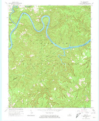
1963 Map of Hail
USGS Topo · Published 1974About this map
Lake Cumberland and the Cumberland River carve a deep, winding path through this portion of the Cumberland National Forest. The 1963 revision documents a landscape defined by sharp ridges and hollows, where small settlements like Hail and Funston occupy the higher ground above the river's dramatic meanders, including Barnett Bend and Haynes Bend. Transport and industry are concentrated in the southwest near Greenwood, where the Southern Railway runs parallel to several hollows and a Gaging Station monitors the waterways.
Find a feature on this map
65 named features on this map. Tap any name to fly to it.
Don’t see what you’re looking for? This feature index may not catch every label — zoom into the map to look around manually.
Map Details
Editions of this 1963 Hail Map
4 editions found
Other maps of this area

1890 · Williamsburg
USGS Topo · 1:125,000

1893 · London
USGS Topo · 1:125,000

1894 · Williamsburg
USGS Topo · 1:125,000

1897 · London
USGS Topo · 1:125,000

1932 · Burnside
USGS Topo · 1:62,500

1935 · Somerset
USGS Topo · 1:62,500

1952 · Hail
USGS Topo · 1:24,000

1952 · Ano
USGS Topo · 1:24,000

1952 · Wiborg
USGS Topo · 1:24,000

1952 · Cumberland Falls
USGS Topo · 1:24,000