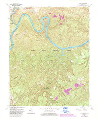
1963 Map of Hail
USGS Topo · Published 1983About this map
Lake Cumberland River and the Cumberland River carve a deep, winding course through the heart of the Daniel Boone National Forest in this 1963 survey. The landscape is defined by its dramatic bends, including Barnett Bend, Jasper Bend, and Haynes Bend, with elevations reaching up to the Normal Pool Elev 723. The rugged interior is crossed by several prominent ridges like Hewling Ridge and Double Tarkiln Ridge, while the remote southern section is home to the Beaver Creek Wilderness. Rural life in McCreary and Pulaski counties centers on small settlements like Hail and Blue John. The local spiritual life is noted by Salem Ch, Cave Creek Ch, and Bethel Ch. Transportation and industry are marked by the Southern Railway passing through Greenwood and several identified mines and strip mines scattered across the eastern ridges.
Find a feature on this map
79 named features on this map. Tap any name to fly to it.
Don’t see what you’re looking for? This feature index may not catch every label — zoom into the map to look around manually.
Map Details
Editions of this 1963 Hail Map
4 editions found
Other maps of this area

1890 · Williamsburg
USGS Topo · 1:125,000

1893 · London
USGS Topo · 1:125,000

1894 · Williamsburg
USGS Topo · 1:125,000

1897 · London
USGS Topo · 1:125,000

1932 · Burnside
USGS Topo · 1:62,500

1935 · Somerset
USGS Topo · 1:62,500

1952 · Hail
USGS Topo · 1:24,000

1952 · Ano
USGS Topo · 1:24,000

1952 · Wiborg
USGS Topo · 1:24,000

1952 · Cumberland Falls
USGS Topo · 1:24,000