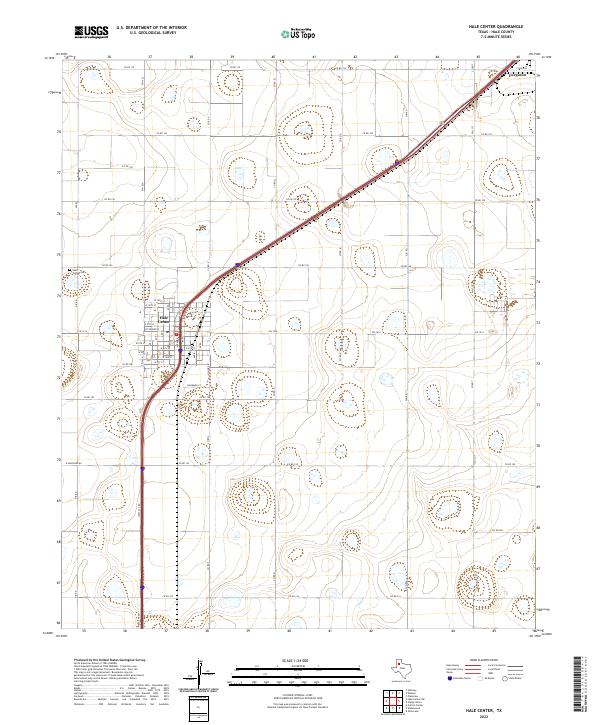
2022 Map of Hale Center
USGS Topo · Published 2022About this map
Hale Center serves as the primary hub of this landscape on the Texas High Plains, where a rigid grid of agricultural roads like Co Rd 165 and Co Rd 180 divides the surrounding terrain. The town's layout is clearly defined by a residential grid featuring W Stevenson and N Main St, with a central Po and the Hale Center Cem situated to the west. This 2022 survey captures the modern infrastructure of the region, including the significant transport corridors of Fm 1914 and West Svc Rd.
Find a feature on this map
47 named features on this map. Tap any name to fly to it.
Don’t see what you’re looking for? This feature index may not catch every label — zoom into the map to look around manually.
Map Details
Editions of this 2022 Hale Center Map
This is the sole edition of this map. No revisions or reprints were ever made.
Other maps of this area

1954 · Lubbock
USGS Topo · 1:250,000

1954 · Plainview
USGS Topo · 1:250,000

1957 · Abernathy
USGS Topo · 1:62,500

1958 · Plainview
USGS Topo · 1:250,000

1965 · Wasson
USGS Topo · 1:24,000

1965 · Plainview
USGS Topo · 1:24,000

1968 · Halfway
USGS Topo · 1:24,000

1968 · Happy Union
USGS Topo · 1:24,000

1968 · Julia Lake
USGS Topo · 1:24,000
1968 · Hale Center SW
USGS Topo · 1:24,000