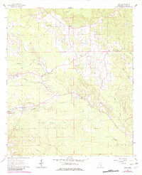
1964 Map of Hale
USGS Topo · Published 1982About this map
Bogue Homo Creek and Shubuta Creek wind through this rural landscape of Clarke County, reflecting a settlement pattern defined by small communities and country churches. The area around Hale and Harmony is dotted with local landmarks like Coke Chapel, George Chapel, and Pleasant Ridge Ch, illustrating the social fabric of the mid-20th century. This 1964 survey, later updated in 1980, reveals a terrain shaped by winding waterways such as Souenlovie Cr and Goodwater Creek. The inclusion of the Base Line and a prominent Pipeline corridor shows the intersection of traditional land divisions and modern infrastructure. For those studying local families, the presence of Harmony Cem and Goodwater Cem provides specific points of interest within the dispersed rural hamlets of Nancy and Hale.
Find a feature on this map
32 named features on this map. Tap any name to fly to it.
Don’t see what you’re looking for? This feature index may not catch every label — zoom into the map to look around manually.
Map Details
Editions of this 1964 Hale Map
2 editions found
Other maps of this area

1953 · Hattiesburg
USGS Topo · 1:250,000

1953 · Meridian
USGS Topo · 1:250,000

1957 · Meridian
USGS Topo · 1:250,000

1957 · Quitman
USGS Topo · 1:62,500

1957 · Enterprise
USGS Topo · 1:62,500

1958 · Hattiesburg
USGS Topo · 1:250,000

1963 · Heidelberg
USGS Topo · 1:24,000

1964 · Heidelberg SW
USGS Topo · 1:24,000

1964 · Eucutta
USGS Topo · 1:24,000

1964 · Hale
USGS Topo · 1:24,000