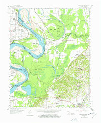
1961 Map of Hales Point
USGS Topo · Published 1977About this map
The Mississippi River and its labyrinthine tributaries dominate this West Tennessee landscape, where the confluence of the Obion River and Forked Deer River creates a complex network of sloughs and cut-offs. The map documents significant hydrological engineering, including the Needham Cut-off and the Old Bed Forked Deer River, which contrast with natural features like Blue Grass Towhead and Moss Island. Inland from the riverbanks, the cultural landscape of Lauderdale County is marked by small settlements such as Chic, Edith, and Tiger Tail. Genealogists will find a high density of rural institutions, including Hickman Chapel, St Marys Ch, and combined sites like Henning Grove Ch & Sch. These landmarks, along with scattered cemeteries such as Pleasant Grove Cem, provide a clear picture of mid-century community life in the Mississippi Delta.
Find a feature on this map
75 named features on this map. Tap any name to fly to it.
Don’t see what you’re looking for? This feature index may not catch every label — zoom into the map to look around manually.
Map Details
Editions of this 1961 Hales Point Map
2 editions found

Other maps of this area

1939 · Dyersburg
USGS Topo · 1:62,500

1939 · Hales Point
USGS Topo · 1:62,500

1939 · Caruthersville
USGS Topo · 1:62,500

1939 · Halls
USGS Topo · 1:62,500

1939 · Blytheville
USGS Topo · 1:62,500

1940 · Hayti
USGS Topo · 1:62,500

1951 · Caruthersville
USGS Topo · 1:62,500

1952 · Hales Point
USGS Topo · 1:62,500

1952 · Gates
USGS Topo · 1:24,000

1952 · Dyersburg
USGS Topo · 1:24,000