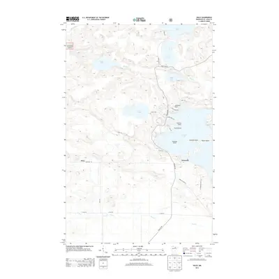
2013 Map of Haley
USGS Topo · Published 2013About this map
Vermilion Lake defines the eastern edge of this landscape, its intricate shoreline dotted with family-named landmarks like Jacobsons Point and Hibbing Point. The area represents a remote portion of Saint Louis County within the Superior National Forest, where the transition from deep forest to water is marked by numerous islands including Ormonds Island and Piccard Island. The interior terrain is a complex network of wetlands and drainage, where the Elbow River and Hoodoo Cr connect a series of smaller basins like Hoodoo Lake, Sunset Lake, and Susan Lake. Human settlement is sparse and concentrated near the road network, with the small communities of Haley and Wakemup serving as the primary local hubs. The local road system, including Crane Lake Rd and Vermilion Dr, provides the only overland access through this heavily glaciated and water-dominant environment.
Find a feature on this map
34 named features on this map. Tap any name to fly to it.
Don’t see what you’re looking for? This feature index may not catch every label — zoom into the map to look around manually.
Map Details
Editions of this 2013 Haley Map
This is the sole edition of this map. No revisions or reprints were ever made.
Other maps of this area

1954 · Hibbing
USGS Topo · 1:250,000

1954 · International Falls
USGS Topo · 1:250,000

1957 · Hibbing
USGS Topo · 1:250,000

1957 · International Falls
USGS Topo · 1:250,000

1958 · International Falls
USGS Topo · 1:250,000

1958 · Hibbing
USGS Topo · 1:250,000

1964 · Hibbing
USGS Topo · 1:250,000

1964 · Linden Grove
USGS Topo · 1:24,000

1964 · Haley
USGS Topo · 1:24,000

1964 · Gheen
USGS Topo · 1:24,000