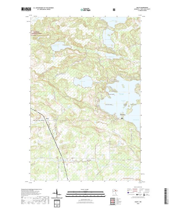
2022 Map of Haley
USGS Topo · Published 2022About this map
Superior National Forest defines the wooded character of this northern landscape, where the small settlements of Haley and Wakemup border the complex western reaches of Vermilion Lake. The terrain is characterized by a dense network of water bodies and trails, including Hoodoo Lake, Sunset Lake, and the winding David Dill-Arrowhead State Trl. Toward the east, the map reveals a jagged shoreline of bays and points, such as Wakemup Bay and Jacobsons Point, alongside several named islands like Piccard Island and Taylors Island. This area reflects a deep connection to both recreational forestry and Indigenous heritage, evidenced by the presence of the Indian Cem near the lakefront. The transition from the dense wetlands around Flint Cr to the more developed cabin sites along Sunset Blvd and Vermilion Dr highlights the area's dual role as a timber resource and a seasonal destination.
Find a feature on this map
52 named features on this map. Tap any name to fly to it.
Don’t see what you’re looking for? This feature index may not catch every label — zoom into the map to look around manually.
Map Details
Editions of this 2022 Haley Map
This is the sole edition of this map. No revisions or reprints were ever made.
Other maps of this area

1954 · Hibbing
USGS Topo · 1:250,000

1954 · International Falls
USGS Topo · 1:250,000

1957 · Hibbing
USGS Topo · 1:250,000

1957 · International Falls
USGS Topo · 1:250,000

1958 · International Falls
USGS Topo · 1:250,000

1958 · Hibbing
USGS Topo · 1:250,000

1964 · Hibbing
USGS Topo · 1:250,000

1964 · Linden Grove
USGS Topo · 1:24,000

1964 · Haley
USGS Topo · 1:24,000

1964 · Gheen
USGS Topo · 1:24,000