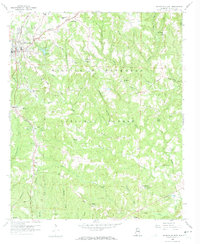
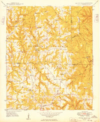
1958 Map of Haleyville East
USGS Topo · Published 1974About this map
The Tennessee Valley Divide cuts across the northern reaches of this Winston County landscape, marking a significant hydrological boundary just above Haleyville. To the south, the terrain falls away into the headwaters of the Buttahatchee River and the deeply dissected valleys of the William B Bankhead National Forest. This 1958 field-checked map illustrates a rural economy rooted in timber and extraction, with Strip Mine operations and gravel pits scattered near the Southern railroad line. Small rural hubs and family-named landmarks like DeFoor and Needmore anchor the backcountry, while a dense network of country churches—including Macedonia Ch, Beech Grove Ch, and Walker Chapel—provides a clear record of local social geography. Notable topographic features like the Bear Tush Lookout Tower stand over the western ridges, overseeing a transition from the structured street grid of Haleyville to the winding paths of the Yankee Trace.
Find a feature on this map
53 named features on this map. Tap any name to fly to it.
Don’t see what you’re looking for? This feature index may not catch every label — zoom into the map to look around manually.
Map Details
Editions of this 1958 Haleyville East Map
4 editions found
Other maps of this area

1936 · Delmar
USGS Topo · 1:24,000

1936 · Kinlock Spring
USGS Topo · 1:24,000

1936 · Phil Campbell
USGS Topo · 1:24,000

1936 · Moulton
USGS Topo · 1:48,000

1936 · Goddard
USGS Topo · 1:24,000

1940 · Mt Hope
USGS Topo · 1:62,500

1946 · Phil Campbell
USGS Topo · 1:24,000

1947 · Phil Campbell
USGS Topo · 1:24,000

1947 · Kinlock Spring
USGS Topo · 1:24,000
1949 · Kinlock Spring
USGS Topo · 1:24,000