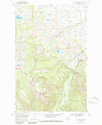
1968 Map of Half Dome Crag
USGS Topo · Published 1985About this map
Blackfeet National Forest and Lewis and Clark National Forest meet in this 1968 landscape, divided by a clear Reservation Boundary. The terrain is defined by the sharp elevations of Half Dome Crag and Kiyo Crag, which overlook a network of drainages including Runner Gulch and Slippery Hoof Creek. While largely a wilderness area of the Northern Rockies, the map records the historical footprint of Palookaville (Site), a named location situated along the North Fork of the drainage system.
Find a feature on this map
27 named features on this map. Tap any name to fly to it.
Don’t see what you’re looking for? This feature index may not catch every label — zoom into the map to look around manually.
Map Details
Editions of this 1968 Half Dome Crag Map
2 editions found
Other maps of this area

1913 · Marias Pass
USGS Topo · 1:125,000

1914 · Heart Butte
USGS Topo · 1:125,000

1918 · Heart Butte
USGS Topo · 1:125,000

1958 · Crescent Cliff
USGS Topo · 1:24,000

1960 · Cut Bank
USGS Topo · 1:250,000

1963 · Cut Bank
USGS Topo · 1:250,000

1964 · Cut Bank
USGS Topo · 1:250,000

1968 · Half Dome Crag
USGS Topo · 1:24,000

1968 · Swift Reservoir
USGS Topo · 1:24,000
1968 · Morningstar Mountain
USGS Topo · 1:24,000